Datasets
366 global labels on PlanetScope co-located with Sentinel-1, Sentinel-2, and Landsat to validate inundation algorithms
366 hand labeled image chips size 1024x1024 in 3 meter resolution in STAC format of labeled inundation for 19 flood events from 2017-2020 including Sen1Floods11, xBD, and NASA Impact events. We recommend using this dataset to benchmark deep learning algorithms of inundation for either Sentinel-1/2 or PlanetScope, to benchmark Geospatial Foundation Model downstream tasks on inundation, or to train deep learning models on any of the three sensors. While some Landsat images are available that are co-located, it is a smaller size than the other sensors. Use with caution. Data are available on Zenodo.
100 global labels on PlanetScope to validate surface water algorithms
100 hand labeled image chips size 1024x1024 in 3 meter resolution in STAC format of labeled surface water across 14 biomes including urban and rural regions, lakes, and rivers, including braided rivers and coastal regions. Data are available on Cyverse.
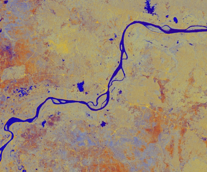
Flood maps for Bangladesh from 2001-2022
Weekly flood maps at 500m spatial resolution, with each pixel representing the fraction of that pixel that is inundated, in .tiff for the entire country from 2001-2022, fusing MODIS and Sentinel-1 observations hosted by CyVerse. Code to reproduce the algorithm or entire database are at this GitHub repository and methods and results described in this paper.
The Global Flood Database
913 flood maps, and .csvs of population exposure metrics for each event are available for view and download at Cloud to Street's website, and in the Google Earth Engine Catalog. Code to reproduce the MODIS algorithm or entire database, data for each country, and all underlying data and scripts to make all figures in the paper are at this github repository.
Mexico City
Data from my dissertation in Mexico City, including urbanization maps, electoral data, zoning changes, and land titling of informal settlements is freely available for download in Spanish from UNAM and in English from ASU.
Data from the Oxfam-Isla Urbana Rainwater Harvesting Project can be made available upon request. These data include water scarcity metrics for every neighborhood in Mexico City, estimates of rainwater harvesting, use, and demand, and the roof area available for rainwater capture.
Flood Maps for Deep Learning
 A dataset produced by Cloud to Street to train and test deep learning models for Sentinel-1 and 2 (Sen1Floods11) is freely available for download from The Cloud to Street Github.
Social Vulnerability to Death and Damage to Floods in the USA
Social Vulnerability model prediction data for 500 year riverine floods in the USA for counties in the USA based on the 2010 census. These data include variables from the census, impervious surface from the NLCD, and population described in the paper Using Disaster Outcomes to Validate Components of Social Vulnerability to Floods: Flood Deaths and Property Damage across the USA, with DOI: 10.3390/su12156006 .